


Tripmate France Lite app for iPhone and iPad
Developer: Emanuele Cipolloni
First release : 30 Nov 2010
App size: 4.46 Mb
When you need timely traffic information, you have to go to the source.
In France, the source is the Autoroutes Trafic web site: detailed and highly readable maps, intuitive symbolism and traffic status updated in real-time.
Unfortunately the Autoroutes Trafic web site uses a technology that makes it unusable on your iPhone, iPod Touch or iPad.
Tripmate France, thanks to its real-time transcoding technology, makes it possible to visualize the portion of Autoroutes Trafic web site concerning the traffic status; it also offers a number of options and parameters to personalize the fruition of the service.
Main features:
- Application completely optimized to facilitate map searching, browsing while on the road without distracting
- Universal application: works on iPhone, iPod Touch and iPad making full use of the hosting device user interface paradigm
- Full use of Retina Display to visualize more details in high resolution (only on iPhone 4)
- National map and Paris Île-de-France; An additional set of 68 detailed maps, covering the whole French motorway network, is available in the full version of Tripmate France
- Maps are automatically cached and only updated traffic status and information are downloaded: faster operation and minimal data download
- Visual research of locations and maps
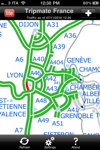
- High contrast colored maps to quickly pinpoint problems on the road. Option to reduce colors brightness (night vision)
- Touch based map moving and zooming
- Ten levels of zoom. All maps are completely vector, when zooming: more details, no blocky pixels
- All maps selected and positioning are automatically cached to allow for fast retrieval of previous selections without searching again
- Status of traffic shown using color codes: free flow, heavy, congested and closed. The segments representing the congested and closed conditions can optionally flash on the screen to enhance the visibility of problems
- Visible/Audible alarms to notify about changed (compared to the previous data update) traffic status and/or information over the currently selected map
- Manual or automatic refresh (with selectable refresh interval)
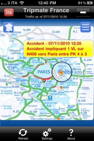
- Road problems/information are shown using icons (accidents, queues, road works, closures). Tapping an icon shows the complete information about the problem
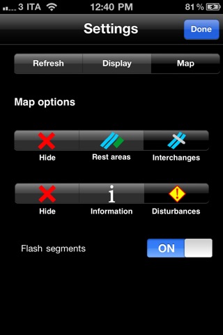
- Level of information shown on the map selectable (Disturbances, Information, Infrastructures)
- Interface available in three languages: French, English and Italian
- Online help always available to quickly explain the meaning of each control and symbols shown by the application